Reprinted from Lake
Winnipesaukee, Compiled & Published
by By Ronald W. Gallup, 1969
The word "island" has an undying
ability to whet the appetite of most people, conjuring up
visions of adventure or privacy as well as fine scenic glimpses.
Lake Winnipesaukee is indeed outstanding in its island numbers
and terrain, from the smallest bare knob to village-sized
meadows and forest.
The oft-repeated saying implies that there are 365 out-crops
large enough to be isles; however only about 274 are habitable,
and of these the most important count to nearly 70, none
owned by the State. Your navigation chart will give
you needed locations and names for your cruise, whether
by sail, excursion boat, yacht, or US Mailboat. If you drive
or hike to the tops of the many look-outs around the Lake,
or ride the chair-lift to the aerial view from Gunstock
Mt., you will be thrilled indeed by the island-beauty spread
far and wide across Lake Winnipesaukee. Few spots in the
world compare with this panorama of grandeur.
Some island facts starting out of Weirs Bay and traveling
clockwise: Stonedam with a height of 216 ft., harbors
the Indian pitch rock, only Indian owned island in 18th
century, later had a stone causeway across Sally's Gut;
Horse was named for the shipwrecked horse that did not want
to leave; Bear of 750 acres, second in size, with an old
Indian "carry" trail, is heavily populated, site
of the first submarine power cable terminus and the first
armored phone cable underwater, and once home of Aunt Dolly
of hand-operated ferry fame; Three Mile, for over 60 years
a summer home of the Appalachian Mt. Club; Beaver that was
once owned by Ben Ames Williams and friends; One Mile where
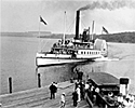
the Mount Washington I ran ashore in the fog in 1910; Becky's
Garden, just off Moultonboro First Neck, once had a "playhouse"
placed each year; Black Cat with year-around access by bridge;
Steamboat, where the steamer "Belknap" was wrecked
in November 1841 (first such disaster) ; Long, 1138 acres,
Winnipesaukee's largest, bridged, once with a flourishing
community, plus the mansion home of Dr. J. A. Greene, who
caused the Diamond Island Hotel to be moved to the Weirs,
whose fortune was based on "Nevura" fame; Guernsey,
settled in 1821, made famous as the first home of Guernsey
cattle in America and named Cow Island, site of the only
windmill gristmill in the region, 519 acres, home of famous
Camp Idlewild, terminus of the second longest submarine
power-cable; Sleeper, with the Graystone Castle of Hale
estate fame; Rattlesnake named for its former snake population,
fifth largest, virgin Pine logged off in 1915, and highest
at 390 feet, being part of the geologic formation of the
Belknap Mts.; Diamond, a favorite resort of the early steamboat
days, from which Dr. Greene moved the hotel across the ice
to the Weirs to start the old Hotel Weirs around 1881; Witches,
a scattering" of rocks, famous for their hazard to
navigation and the "witches legend"; Governor
which once belonged to Gov. Wentworth (whose mansion burned
in 1870), site of Davisville a prosperous hamlet where the
1834 Millerite 'sect craze took place, Davis Island bridged
1820, location of the German Embassy summer mansion before
1915, 495 acres and fourth largest.
The days of boundary disputes, timber piracy, mansion estates,
and island farms have been replaced by summer cottages and
children's camps; but the varied and numerous islands of
Winnipesaukee are little changed, retaining a unique pristine
allure.